As stated on their website, "The Provincial Archives of New Brunswick collects, preserves, and makes available for research, documents and records bearing upon the history of New Brunswick."
In other words, it's a gold mine of information for genealogists. And once again, we hit pay dirt. We didn't actually find what we had primarily been looking for - where my great great great great grandfather Samuel Upton and his son John were buried - but what we did find was so gratifying that I just couldn't be too disappointed. And we had another serendipitous encounter that was the proverbial icing on the cake.
First, a wee bit of background: I knew that Samuel Upton had moved to New Brunswick from Salem, Massachusetts in the 1760s. And I knew he and his son John were both buried in New Brunswick. Somewhere.
But during the course of this trip, before visiting the Provincial Archives, I had also learned the following: Samuel had received a land grant from King George III of England in 1765 for 500 acres of land in what was then Nova Scotia, but is now Maugerville, New Brunswick (this part of Nova Scotia then became the province of New Brunswick in 1784). After the Acadians were driven out of Nova Scotia, the British wanted to make certain there was a strong British presence in the area and the awarding of land grants was the result.
That was pretty exciting to find out because that meant there might be a paper trail.
And sure enough, there was. At the Provincial Archives, we actually found the land grant. We were also able to see a copy of the original map that showed the land grants and where they were located. And there was Samuel's name, written on the map, showing where his 500 acres were.
We knew that it would be difficult, 243 years later, to find the actual land. We had no idea what might be out there. Housing developments? Office complexes? Shopping malls? But we had to at least try.
So we drove from Fredericton to Maguerville, only about 15 miles away. We could tell from the old map that Samuel's land fronted on the St. John River and then went back from there...waaay back. For five miles. All the land grants awarded at that time in that area were long and skinny strips. Art and I figured it was so everyone would have access to the river, which was the main transportation route back then.
Surprisingly - and pleasantly so - there were no housing developments or office complexes or shopping malls. There were a few homes, a few farms, a few green stands, an old gas station and lots of land. But where had Samuel lived? In present time, there is a public road that parallels the St. John River, so we knew we were at least driving over a tiny piece of what would have been his land, but we just couldn't tell which plot would have been his. We decided we had best just be content knowing we were in the area.
We had not been able to find out at the Provincial Archives where either Samuel or John were buried, but as we passed an old church in Maguerville on our way back to Fredericton, we decided to stop and just poke around the cemetery at the church. No Uptons. We climbed back into the Jeep and were just starting to pull back onto the road, when another car drove into the tiny church's parking area. A woman got out of the car and started walking towards the church. On a whim, I hopped out of the Jeep, mainly to ask her if she happened to know if this particular church might have any records of burials. Both Art and I now know from experience that not all burials are marked with headstones, but churches and cemeteries always seem to have recorded all burials.
The woman said she knew that the Provincial Archives would have this particular church's records because it's such an historical church (established in 1763). Phooey. We had not thought to check into church records when we were at the Archives that morning.
She then asked who we were looking for. When I mentioned Samuel's name, she said "I don't know if he's buried here or not, but I live on what was Samuel Upton's land grant."
Serendipity.
She had some things to do at the church, but she gave us directions to her house and permission to take a photo. This may sound corny, but standing there, looking at land that was owned and farmed by my great great great great grandfather, well, all those "greats" just evaporated and I wouldn't have been surprised to see him walk out of the woods. It was a very special moment.
This wonderful woman we met at the church also told us about a man living in the area...a 91-year old gent who turned out to be my fifth cousin! We actually got to visit him for a bit. He was quite amused by our "accents".
So even though our visit to the Provincial Archives did not give us exactly what we were looking for, I think it did give us what this particular Upton was REALLY looking for...a connection.
And we will be heading back to Fredericton sometime next month, on our way to Maine. We plan to make another visit to the Provincial Archives to check out those church records.
I'll find you yet, Samuel Upton!

This church was established in 1763 and we believe it is the one Samuel would have belonged to...it was literally a stone's throw from his land.

Samuel, are you there?

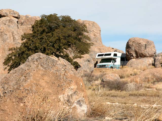
The part of Samuel Upton's land grant that was near the St. John River.
--- Barbara (currently in North Sydney, Nova Scotia)
Day 63
Total miles: 6,723
1 comment:
Tell me. Do you whistle as you walk past the graveyard...?
Post a Comment